A government-issued map becomes a fashionable family keepsake.
When Ted Maxwell was a young boy in the 1950s, he remembers his mother, Bernice Allen Maxwell, wearing a distinctive blouse. Made from richly printed silk, the blouse resembled a map of Europe—one that highlighted roadways in such countries as France, Belgium, Germany, and Italy. What Maxwell didn’t understand at the time was that the blouse had been made from a real map, one that had belonged to his father, John W. Maxwell.
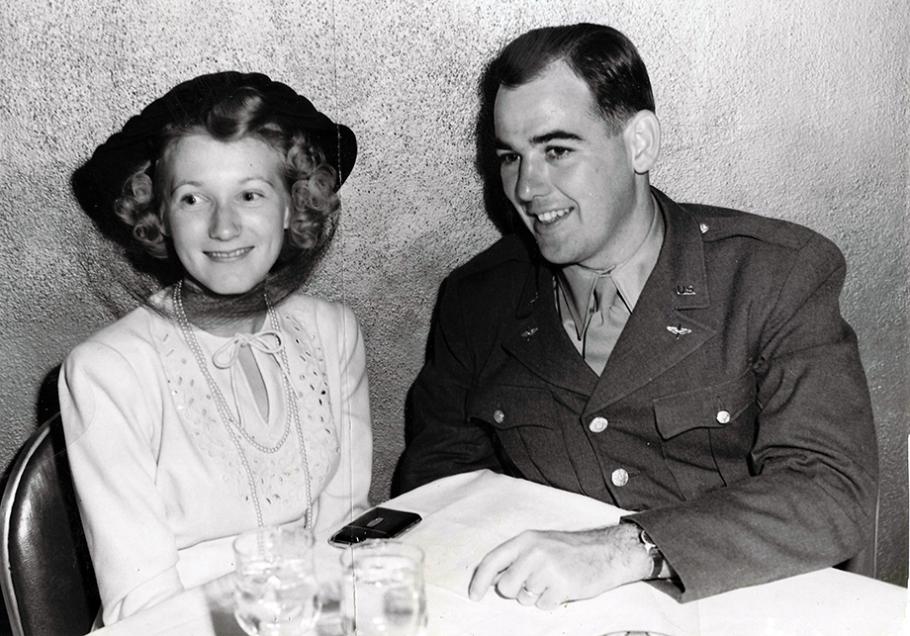
Bernice and John Maxwell on their wedding day in December 1942.
The map came into John’s possession during World War II, when he was a pilot in the U.S. Army Air Forces. Like thousands of other Allied airmen, John had been issued the map (silk maps were more durable than paper ones) to help him evade capture and escape to safety in case he had to bail out over enemy territory.
John had been drafted into the U.S. Army in July 1941, and had never had any intention of becoming a pilot. Pearl Harbor changed his mind. On the morning of December 7, 1941 (a Sunday), John and other soldiers assigned to the Army’s 34th Engineers in Oahu were awoken by the sound of shots ripping through their barracks. “My father decided to become a pilot after seeing bodies flying at Hickam Field,” says Maxwell.
In 1942, John transferred to pilot training school in Yuma, Arizona. By May 1944, he was based in England as a pilot with the 441st Troop Carrier Group. Flying a Douglas C-47, John was part of a mission that dropped troops into France on D-Day (June 6, 1944). Of his father, Maxwell says: “He sure was a talker about everything else, but he didn’t talk much about the war.”
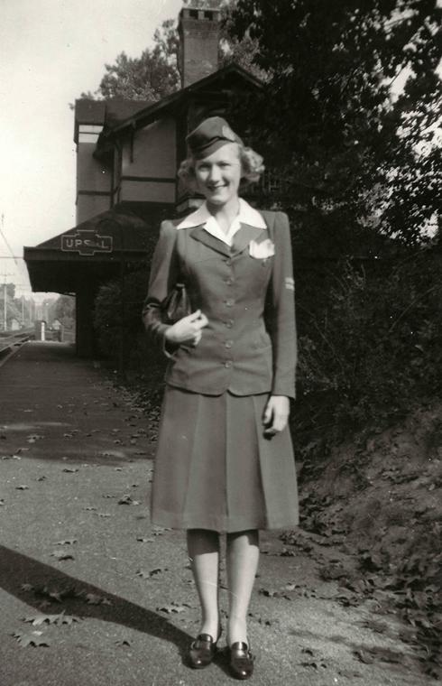
In the early 1940s, Bernice Allen Maxwell worked as a stewardess-nurse for the Silver Meteor Seaboard Railway. Wearing her company uniform, Maxwell stands in front of the Upsal train station in Philadelphia. As a child, she and her family lived in the apartment above the station.
While John was overseas, Bernice kept busy stateside. She worked as a nurse before becoming a stewardess-nurse for the Silver Meteor Seaboard Railway. Like John, Bernice had grown up in Philadelphia, where her father was a railway ticket agent for more than 50 years. As a child, she and her family lived in the apartment above Philadelphia’s Upsal Station.
On October 12, 1945, John ended his military service, and sometime after that, Bernice made the blouse using her Singer sewing machine. Silk was still in short supply due to wartime rationing, and Bernice thought her husband’s map “had a nice pattern,” says Maxwell. She wore it for special occasions. A family heirloom became a museum artifact when Maxwell—who is a former associate director at the National Air and Space Museum—donated it in 2010. The blouse is also a symbol of survival. Says Maxwell: “If my father had needed to use his escape map, I probably wouldn’t be here.”
Diane Tedeschi is Air & Space Quarterly’s senior editor.

This article is from the Spring 2024 issue of Air & Space Quarterly, the National Air and Space Museum's signature magazine that explores topics in aviation and space, from the earliest moments of flight to today. Explore the full issue.
Want to receive ad-free hard-copies of Air & Space Quarterly? Join the Museum's National Air and Space Society to subscribe.