

Geography from Space Quiz 2

Question 1 Clue:
A mighty river, about 6400 kilometers (4000 miles) long, runs across this continent that is home to the largest tropical forest in the world. A long mountain range extends along its western edge. Name the continent.
Image from Blue Marble courtesy of NASA's Earth Observatory
South America
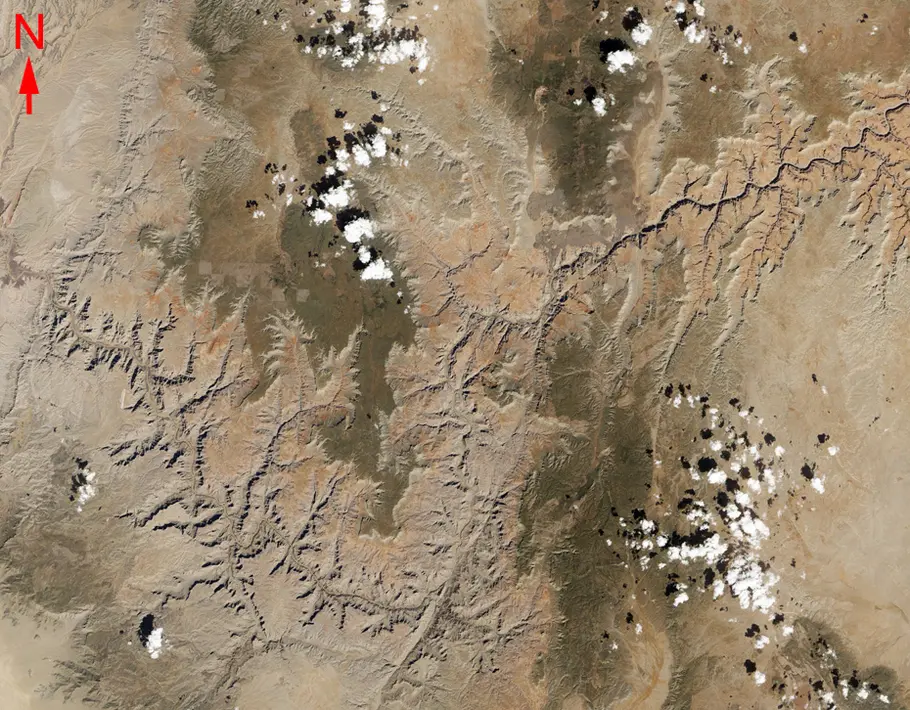
Question 2 Clue:
This year marks the 100th anniversary of the U. S. National Park Service. The scenic feature pictured here is about 1.6 kilometers (1 mile) deep and was designated a National Park in 1919. Name this National Park located in Arizona.
Landsat 8 image courtesy of USGS and NASA
Grand Canyon

Question 3 Clue:
In this nighttime image, this country's lights sparkle revealing where people live. The brighter clusters are from cities, such as Chennai (blue arrow). Name the country.
Suomi NPP image courtesy of NASA and NOAA
India

Question 4 Clue:
This capital city lies on the Chao Phraya River (white arrow) which empties into the Gulf of Thailand. Name the city.
International Space Station Image courtesy of NASA/JSC
Bangkok

Question 5 Clue:
Located in the Indian Ocean, this country (white arrow) is the fourth largest island in the world. It is separated from east Africa by the Mozambique Channel. Name the country.
Image from Blue Marble courtesy of NASA's Earth Observatory
Madagascar

Question 6 Clue:
This snow-capped mountain range is 1200 kilometers (750 miles) long and crosses 8 countries. The city of Venice (yellow arrow) is 520 kilometers (320 miles) to the south of the mountains. Name the mountain range.
Terra-MODIS Image courtesy of NASA/GSFC
Alps

Question 7 Clue:
This ring of Greek islands is located in the Aegean Sea. The largest, Santorini, is a popular tourist site. These islands are all that remain of a once larger island that was blown apart by an explosive event. What caused the explosive event?
International Space Station Image courtesy of NASA/JSC
Volcano

Question 8 Clue:
This image reveals a section of a human-built waterway (orange arrows) that was originally constructed in the 19th Century. It connects the Mediterranean Sea to the Red Sea, and was enlarged and expanded last year. Name the waterway.
Landsat 8 image courtesy of USGS and NASA
Suez Canal
This quiz was originally published in 2016.