

Geography from Space Quiz 7
Question 1 Clue:
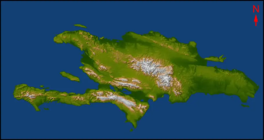
Located in the Caribbean, the island of Hispaniola contains two sovereign nations. The country occupying the western third of the island was struck by a devastating earthquake in January 2010. Name the country.
SRTM image courtesy of NASA/JPL/NGA
Haiti

Question 2 Clue:
In April 2010, an oil rig explosion caused a massive oil spill in the Gulf of Mexico. In this image, an oil slick (arrow) lies only 50 kilometers (30miles) from the delta formed by a North American river. Name the river.
Aqua/MODIS image courtesy of NASA Earth Observatory
Mississippi River

Question 3 Clue:
This island nation is home to many active volcanoes. A plume of ash and steam, visible along the southern coast, rises from a volcano that erupted in March 2010. It produced an ash cloud large enough to shut down airports across more than 20 European countries. Name the island nation.
Aqua/MODIS image courtesy of MODIS Rapid Response Team, NASA/GSFC
Iceland
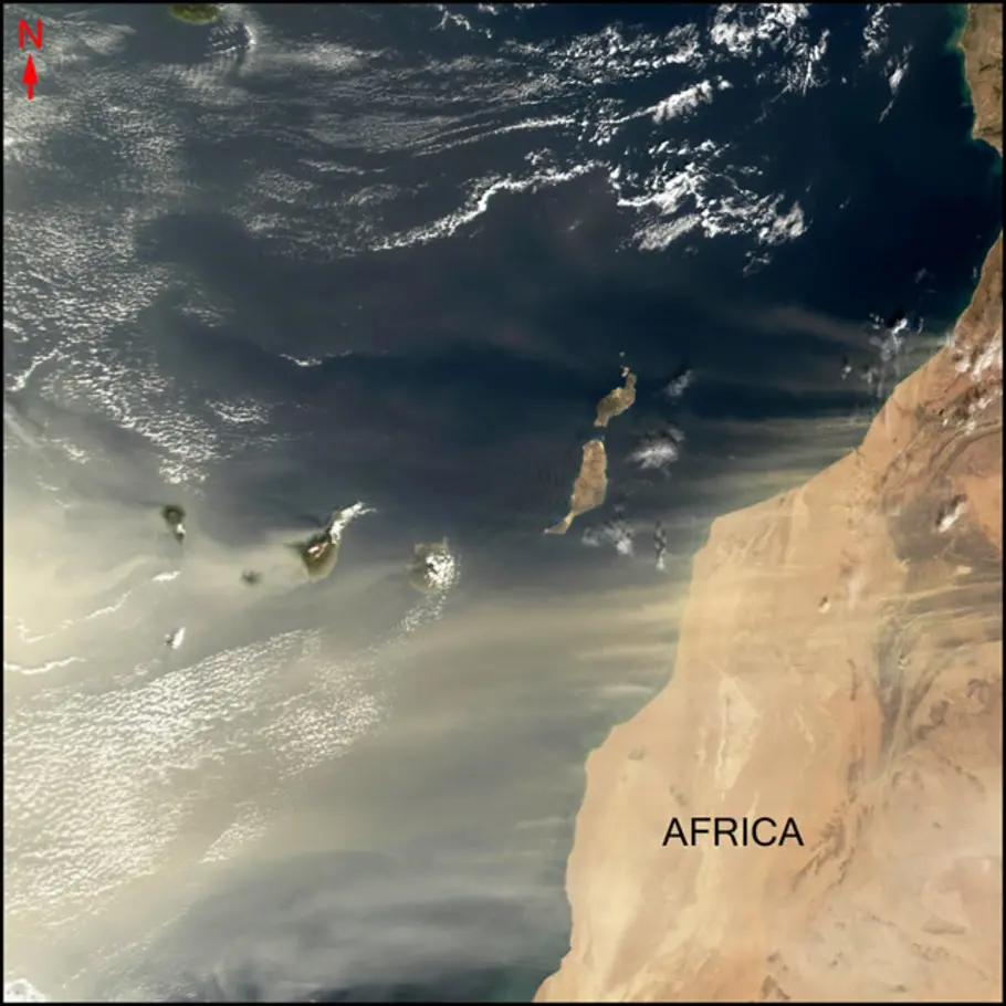
Question 4 Clue:
A cluster of Spanish volcanic islands lies off the coast of northwest Africa. The largest island is called Tenerife. A well-known type of bird was named after these islands. Name the island group.
Terra/MODIS image courtesy of MODIS Land Rapid Response Team, NASA/GSFC
Canary Islands

Question 5 Clue:
McMurdo Station (arrow) is a research center on Ross Island. Icy McMurdo Sound lies off the coast of a large landmass. Name the landmass.
Landsat mosaic courtesy of U.S. Geological Survey
Antartica

Question 6 Clue:
The waters of this U.S. Great Lake (arrows) drain via the Niagara River and Niagara Falls into neighboring Lake Ontario. The shallowest of the Great Lakes, it is also the warmest in the summer and often freezes in winter. Name the Great Lake.
Aqua/MODIS image courtesy of MODIS Rapid Response Team, NASA/GSFC
Lake Erie

Question 7 Clue:
The long, braided Brahmaputra River flows from the upper right along the base of the Himalayas. It then turns south where it is called the Jamuna, and is joined by another river flowing from the west (arrow). Waters from both rivers flow into the Bay of Bengal. Name the river marked by the arrow.
Terra/MODIS image courtesy of MODIS Land Rapid Response Team, NASA/GSFC
Ganges
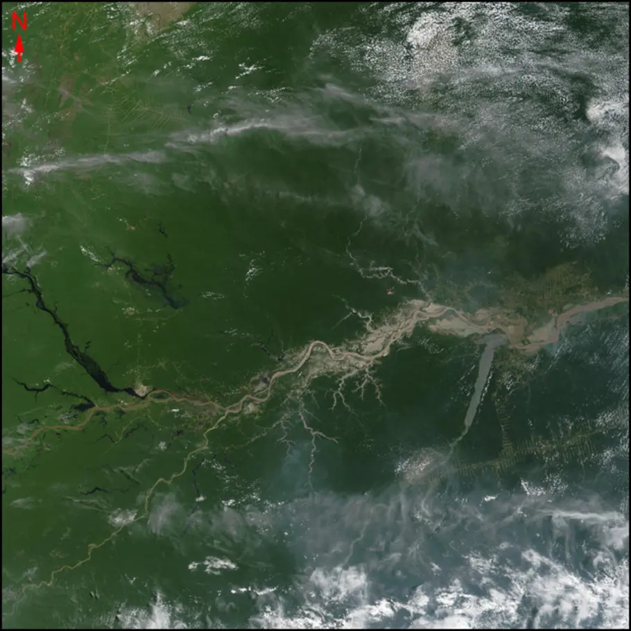
Question 8 Clue:
The muddy brown waters of South America’s longest river flow from west to east across this scene. Name the river.
Terra/MODIS image courtesy of MODIS Rapid Response Team, NASA/GSFC
Amazon River
This quiz was adapted from quizzes published in 2011 and 2010.