Soar Together at Air and Space | Family Activities
This program focuses on the connections between the National Oceanic and Atmospheric Administration (NOAA) and aviation and space, and how their work plays a role in your life, every day.
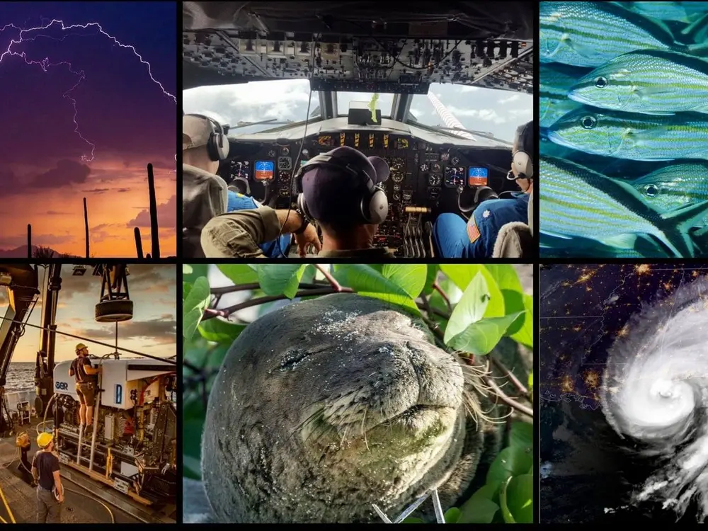
What is NOAA and how does their work overlap with the work of the National Air and Space Museum?
Explore NOAA's work- WATCH → GATHER → INFORM -and then try it out yourself!
Using crewed and uncrewed aircraft , NOAA makes observations of marine life to help us learn more about animal behavior and populations.
Think about it! Why are drones a useful tool for studying animals?
Gather
Once observation data is collected, scientists compare new and old data to help them identify patterns and make predictions that will help us understand what's happening in our world.
In this example, cameras from fixed stations and drones are used to collect as many observations of Steller sea lion rookeries in Alaska, to help scientists learn more about population trends and make decisions on the best way to protect them.
Look closely at the images below. These are observations taken 30 years apart from each other at the same Steller sea lion rookery. One is from a remote camera station and the other is from a drone.
What do you notice that is the same?
What do you notice that's different?
How do you think scientists use this information?
Inform
How does ocean animal research affect your everyday life?
A screenshot of a page on the FishWatch U.S. Seafood Facts website which focuses on the Alaska Pollock.
Steller sea lions are an important part of the Alaskan ecosystem. Western Steller sea lions populations are endangered for several reasons. One is the effects of fisheries on their prey - fish like pollock and mackerel – that may reduce prey numbers or shift locations where prey is available. This fishing pressure, combined with changes in ocean conditions, led to less sea lions being able to live and have babies. NOAA's research helps the government make decisions on how to best protect this species while allowing people to still eat fish.
NOAA's Fish Watch website provides information on how you and your family can make the best seafood choices that help the environment and marine ecosystems.
Watch
Using aircraft and satellites, NOAA makes observations of the Earth to help us learn more about what is happening on the surface and in the atmosphere. These observations are especially helpful when it comes to predicting and monitoring extreme weather, like hurricanes, tornados, thunderstorms, flooding, and more.
Watching from Space
This video shows how a special satellite called GOES-R is used to collect weather observations from 22,000 miles above Earth!
Learn more about the GOES-R series of satellites and what they can do!
Think about it!
How does the satellite make observations like you do? How is it different? (Hint: Do you speak the same language as the satellite?)
How is the satellite information shared with the public?
Watching in the Sky
Hurricane Hunters are a crew of pilots and scientists who fly aircraft into hurricanes to make observations of what is happening IN a hurricane!
Think about it!
What data would you be interested in collecting from a hurricane?
What tools would you use to get the data?
What data can an aircraft provide that a satellite cannot?
Gather
Once observation data is collected, scientists compare this new and old data to help them identify patterns and make predictions that will help us understand our weather's impact on the Earth.
This time lapse video shows satellite data of Hurricane Dorian from Aug. 29, 2019 — just a day after the tropical system became a hurricane — until Sept. 3, 2019. These images together show the path of the storm and help NOAA scientists warn those in the storm's path.
Watch this GOES East timelapse of Dorian from Aug. 29, 2019 — just a day after the tropical system became a hurricane — until Sept. 3, 2019, when the dangerous storm began to pull away from the Bahamas and headed for the U.S. mainland.
The G-IV will drop 30 to 40 dropsondes during a flight, sending the information back for forecasters to use in their models to develop the hurricane forecast track.
Inform
This is the part of NOAA's work that you might be the most familiar with, without even knowing it! NOAA shares the patterns and predictions about the weather to help us prepare for our everyday lives.
For example, NOAA’s National Hurricane Center and your local Weather Forecast Office provide a play-by-play as storms develop during hurricane season to help people prepare. Learn more about how to use the information they provide.
As part of your exploration of the work of NOAA, create an observation journal, using some of the same techniques NOAA does to WATCH - GATHER - INFORM.
You'll need the following supplies: A notebook or several sheets of paper stapled together; something to write with.
Step 1 - Watch
Practice making observations using the tools you carry around with you everyday - your 5 senses! While NOAA uses aircraft and satellites to make their observations, you're going to make ground level observations.
Here's what to do:
Pick a spot in your front or back yard, or neighborhood. Make sure it's a place you can go to for 7 days in a row.
Write in your notebook where your spot is located. This could be an address, or the town or city.
Create a table like the one below in your notebook. This will help you organize your observations.
Close your eyes, take a couple of deep breaths and then open your eyes. Look around - what do you notice?
Make notes in your notebook. If you want to draw pictures, that's fine too!
Estimating Wind Speed
Take a look around your observation space - do you see or feel any wind? Check the chart above and pick whichever term is closest to your observations, then mark it down in your journal!
Estimating Cloud Clover
How much of your sky is covered by clouds? Look around your observations space and see where the clouds are, then compare it to the examples above. Pick the picture that looks closest to your observations, and record your estimated cloud cover in your journal!
Step 2 - Gather
Collect enough data so you can look for patterns in your observations.
Go to your observation spot and make observations for 7 days in a row. If you can take observations for more than 7 days, the better.
Try to make your observations at the same time each day. If you can't, that's OK! Just make a note of what time you make your observation.
Once you've collected your observations for 7 days, look at your notes - do you see any information that is repeating? What weather patterns do you notice? Were there animals that you noticed often?
Want to take your data gathering to the next level?
Download the mPing app which allows you to record observations of the weather in your area and share it with NOAA scientists. See the Citizen Science section below for more information.
Sample mPing data
Participate in citizen and community science projects.
Put your observations skills into practice and help NOAA scientists!
mPing - use this app to report the weather in your area for the National Severe Storms Laboratory.
I See Change - using this app, you can share the weather in your area and how it is affecting you and your community.
Marine Debris Tracker - learn more about how you can track where you see litter in your area! This helps scientists create a map of pollution that will eventually end up in the ocean, and understand the problem more.
NOAA in the Collections
The National Air and Space Museum collects artifacts that tell the history and stories of flight and its relationship to our community. Scroll through some of the artifacts we have from NOAA.
9 Images
Gallery slides
Slide 1 of 9
Badge for the NOAA Hurricane Hunters, a group of aircraft used for hurricane surveillance and study. The crews make observations to help scientists and weather forecasters gather research data.
Slide 2 of 9
These pilot wings, or aviator insignia, are awarded to NOAA Commissioned Officer Corps pilots and navigators.
Slide 3 of 9
TIROS, the Television Infrared Observation Satellite, was the world's first weather satellite. It launched in April 1960 and flew for three months, helping scientists and weather forecasters observe large scale weather patterns around the globe for the first time. The TIROS program is still in operation today, with several TIROS satellites currently in orbit!
Slide 4 of 9
Patch for the NOAA Aircraft Operations Center (AOC). The AOC is located in Lakeland, Florida and serves as the main base where all of NOAA's aircraft live, including the Hurricane Hunters.
Slide 5 of 9
Scientists at the U.S. Weather Bureau, which later became NOAA, created this camera attachment to fly on the Gemini space missions to help astronauts measure cloud height by taking spectrum and infrared images. This camera was a backup for two others that went into space on Gemini V and VIII.
Slide 6 of 9
This radiosonde is a a collection of scientific instruments that was designed to be attached to a weather balloon. It collects data as the balloon rises, then after the balloon eventually bursts at high altitude, the radiosond descends via a small parachute.
Slide 7 of 9
This Microwave Sounding Unit (MSU) was designed to observe the atmosphere’s temperature, pressure, water vapor, and critical trace gasses and was the flight spare for TIROS-N operational weather satellite series. Launched in 1978, TIROS-N was an experimental step to determine if satellites could be useful in the study of the Earth. The goal was to improve satellite applications for Earth-bound decisions such as, “should we evacuate the coast because of the hurricane?” It will be on display in NASM’s new One World Connected Gallery.
Slide 8 of 9
The GOES-Q Imager was designed to capture imagery of weather and atmospheric phenomena from 22,240 miles above the equator. Designed to fly on an earlier generation of Geostationary Operational Environmental Satellites (GOES), this imager wasn’t needed because the existing GOES satellites were performing well past their expected lifetimes. It will be on display in NASM’s new Living in the Space Age Gallery.
Slide 9 of 9
The GOES-Q sounder was designed to provide information about the vertical distribution of atmospheric temperatures and water vapor for weather prediction models and short-term severe weather forecasts. The GOES-Q Sounder didn’t get to fly in space because the existing Geostationary Operational Environmental Satellites (GOES) at the time were outperforming their life expectancies and construction of the GOES-Q satellite was cancelled in 2002. This sounder will be on display in NASM’s new One World Connected Gallery exhibit on climate change.
A live, all-star panel of scientists from NOAA, focused on the connection between aircraft, understanding marine species and supporting conservation efforts.
A live all-star panel of scientists from NOAA focused on monitoring weather around the world.
Did you enjoy these activities?
Sign up for our mailing list to get notified when more activities like this become available, learn about upcoming family days, get reminders to sign up for other family-friendly programs like virtual planetarium shows and story times, and more.