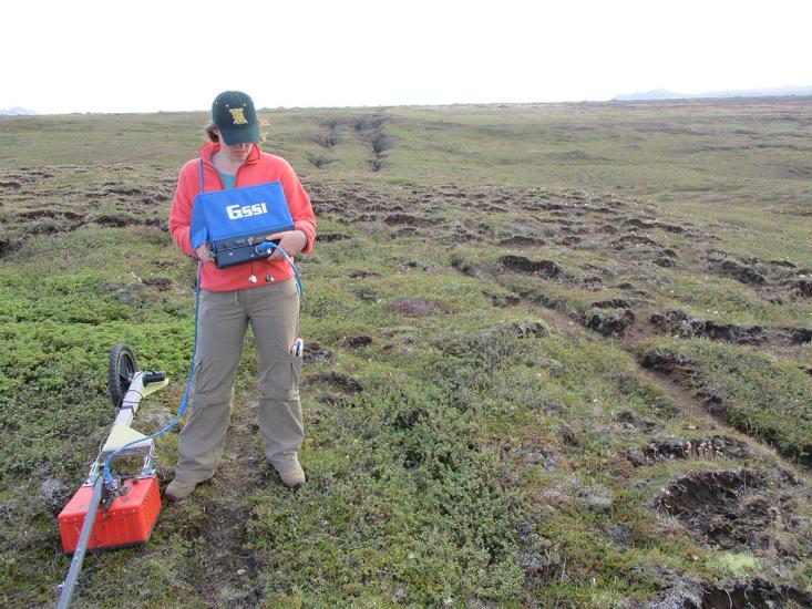
Using the ground penetrating radar system to image the location of the soil-bedrock boundary. I am holding the control unit and the antenna is the orange box on the ground. Note the two parallel pit chains in the background. Image credit: E. Martin and J. Whitten.