The Technology Behind D-Day's Moonlit Airborne Ops
Jun 05, 2019
By Roger Connor
Retaking Western Europe from German control was an enormous undertaking for the Allies in the summer of 1944. The D-Day invasion on June 6, 1944, posed particular challenges to avoid the disaster of the earlier trial invasion of Dieppe. American and British commanders knew that to sustain the beachhead, the operation had to happen with surprise and overwhelming force at the landing grounds. To do this, Supreme Allied Commander General Dwight D. Eisenhower relied on paratroop and glider landings to secure the flanks of the Allied forces landing on the five invasion beaches and reinforce them. The Americans would cut off the Cotentin peninsula to the west and the German forces at Cherbourg, while British paratroops and glider-borne infantry secured the eastern flank. However, airborne assaults had a decidedly mixed record. While the Germans had amazed the world with the airborne capture of the Belgian Fortress of Eben-Emael in 1940, the German airborne landings on Crete and the American effort on Sicily had suffered devastating losses, in spite of eventually achieving their objectives. As risky as those operations had been, Eisenhower's plan added another enormous peril and complication -- landing in moonlit darkness.
The complications arising from this plan have played out in a number of Hollywood productions, ranging from D-Day Sixth of June (Twentieth Century-Fox, 1956) to Saving Private Ryan (Dreamworks, 1998), and Band of Brothers (HBO, 2001). Those productions depict an airborne operation gone wrong with heavy losses to flak and paratroopers being scattered about the countryside. In some of the drops, this did indeed happen, resulting in particularly dramatic episodes, which make for great viewing. However, most of the drops went far more smoothly and were too boring to depict on screen. This has resulted in some significant mythmaking about how airborne forces were used and obscures the reality of some truly remarkable hidden stories.
The American and British airborne operations were largely successful in their objectives because of a combination of planning, training, and technology. This blog will detail the key technologies deployed on the "pathfinder" transports that led the forces to their drop zones (paratroopers) and landing zones (gliders). The drops were only possible because of significant Allied advances in the electronics industry, resulting in three specific systems that would have enormous impact -- the Gee navigational system, the SCR-717 navigational radar, and the Rebecca-Eureka beaconing system. None of the three were developed specifically for airborne operations, but all three were critical for the four major Allied airborne operations in the last year of the war (D-Day, as well as Operation Dragoon in Southern France, Operation Market Garden in Holland, and Operation Varsity in Germany).
All three of the key pathfinder technologies highlighted the close Anglo-American cooperation that was the hallmark of the defeat of German forces in Western Europe. The development of these systems was almost exclusively British, created by the engineers of the Telecommunications Research Establishment (TRE). American engineers at the MIT Radiation Laboratory (Rad Lab) helped refine the SCR-717C and Rebecca-Eureka systems for mass production in the United States for use on American aircraft, while Gee was built in Britain for both British and American operations.
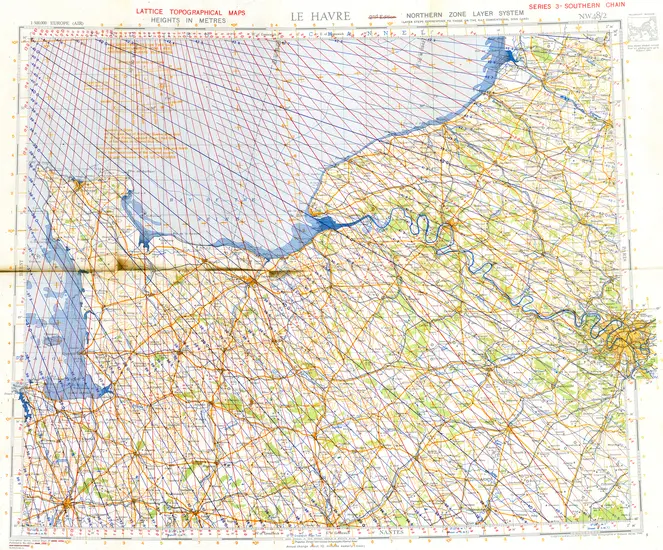
Gee was a navigation system designed to guide Royal Air Force bombers after a series of disastrous navigational errors early in the war. Operating on the hyperbolic line of position principle, Gee could give positions to a few miles accuracy in night and bad weather, though it was susceptible to jamming. It used chains of stations based along the British coast to generate the guidance signals, while the pathfinder navigators used a cathode ray tube display at their stations to analyze the time differential between signal reception and then plot them on a specialized chart that would give a line of position. Two such lines of position readings would give a position.
For all-weather navigation, British and American bombers used Gee receivers, like this Type 62A Gee Mark II example, extensively on D-Day and during the Normandy campaign. With modified ground stations it was also useful in relatively accurate “blind bombing” missions.
Lent by the National Electronics Museum.
The SCR-717C was a microwave navigation radar that could see shorelines, rivers, and cities. Unlike, Gee, the radar was entirely contained on the aircraft. A large radome mounted below the C-47 transport housed the rotating dish that emitted the radar waves, which reflected off the terrain. The pathfinder navigator used a cathode ray tube to see the terrain around the aircraft.
Though the IX Troop Carrier Command did not use the C-46 depicted here until after its D-Day drops, this picture showcases the Pathfinder equipment used on the C-47s. The larger radome under the fuselage is the SCR-717C navigational radar. The antennas on either side of the nose are for the Rebecca receiver.
Rebecca-Eureka was originally developed by the British to allow naval aircraft to assemble formations at sea and to guide fighters for close support operations to prevent friendly fire. The system consisted of a Rebecca transmitter on the aircraft and a Eureka beacon on the ground positioned by specially-trained advance teams dropped into position ahead of time. The beacon acted as a transponder, giving not only directional guidance, but also distance information. Rebecca-Eureka had received its baptism of fire with American forces the previous September when the 82nd Airborne used it on a drop in support of the Salerno beachhead in Italy with promising results.
Intended to give transport aircrews range and direction to a para-dropped pathfinder beacon (known as Eureka), this system also proved useful as an IFF transponder. Like many wartime microwave systems, the Rebecca-Eureka airborne guidance beacon originated as a British Telecommunications Research Establishment project that later benefitted from American advancements in miniaturization and manufacturing.
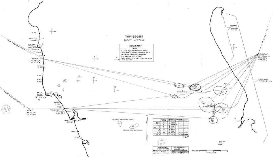
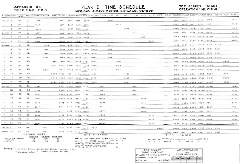
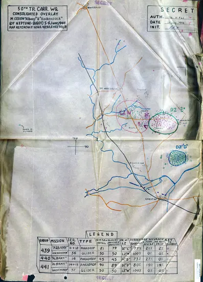
Not long after sunset on June 5, twenty IX Troop Carrier Command C-47s began departing British airfields for the runs over the Cotentin peninsula drop zones to deliver the pathfinder teams with their Eureka beacons. Thirty lead pathfinder C-47s would home in on the beacons with the main formations of 824 C-47s and 105 CG-4 gliders, carrying approximately 15,000 American airborne troops. The drop zones and entry/exit paths were planned for areas without significant concentrations of German forces and heavy flak guns. Nonetheless, some of the pathfinder pilots who had not experienced enemy fire before increased their planned airspeed from 90 mph to 150 mph and increased altitude from 500 feet to 2,000 feet, causing some of the drop zones to have greatly increased dispersion of the paratroops. However, the majority of the twenty pathfinder Eureka beacons were up within ten minutes, even though one team had unknowingly landed a mile off its target.
Though post-dating the Normandy operation, this photo shows what a Eureka-equipped pathfinder team looked like prior to drop.
Fortunately, the enormous technical investment in the three navigational systems paid off as the thirty formation-leading pathfinders soon realized that the misplaced Eureka beacons were leading them off course based on discrepancies with the shoreline revealed by the SCR-717C scopes. Only 150 of the C-47s released their paratroops based on Rebecca-Eureka guidance (including 20 on the one dropped a mile off target). The remaining aircraft dropped on Gee guidance with good accuracy. Special Gee frequencies had been set aside so the Germans would not be able to jam until it was too late, and the effort was a great success. This was most apparent when the pathfinders attempted to use light signals to guide the main force aircraft, but were consistently fired upon, so that nearly all drops were made electronically (with most planes waiting for their electronically equipped formation leader to begin dropping).
For perhaps a quarter of the American paratroops that landed in the early morning hours of June 6, 1944, the Hollywood representation has basis in reality. However, as a whole, as after action assessments demonstrate, the majority of the drops went as planned with sufficient concentrations available to cut off Cherbourg and successfully secure the flank of the landing beaches.
This was only possible with the aid of the scientists and engineers that helped ensure that the Allies had an overwhelming advantage in electronic capabilities. If the Germans stood their ground effectively in the Normandy hedgerows over the following weeks, the airborne landings showed that they had long ago lost the battle for the electromagnetic spectrum.
The three core technologies used in the airborne drops would evolve even further and become even more important. The development of Gee in Britain helped inform development of LORAN in the United States, which became a critical system used well into the early 21st century, and helped inform development of GPS. The Rebecca-Eureka equipment proved remarkably adaptable and helped launch electronic Identification Friend and Foe (IFF) equipment for the military, as well as civilian transponders for air transport operations and Distance Measuring Equipment (DME). Radar of the SCR-717C type has continued to evolve and become ever more central to civil and military operations.
Related Topics

We rely on the generous support of donors, sponsors, members, and other benefactors to share the history and impact of aviation and spaceflight, educate the public, and inspire future generations. With your help, we can continue to preserve and safeguard the world’s most comprehensive collection of artifacts representing the great achievements of flight and space exploration.
Support the Museum
We rely on the generous support of donors, sponsors, members, and other benefactors to share the history and impact of aviation and spaceflight, educate the public, and inspire future generations. With your help, we can continue to preserve and safeguard the world’s most comprehensive collection of artifacts representing the great achievements of flight and space exploration.


