
Sep 06, 2022
By James David
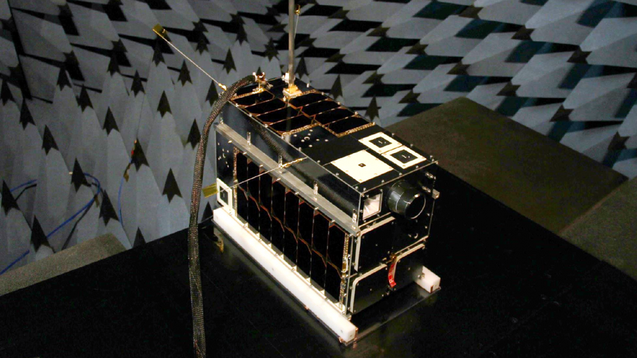
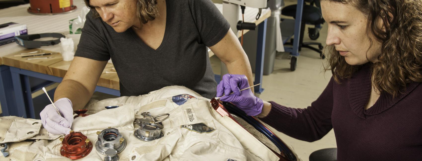
Our Museum recently acquired a first-generation HawkEye 360 Pathfinder satellite, which will be displayed in the new Raytheon Technologies Living in the Space Age exhibition that is anticipated to open in 2026 in our National Mall location. HawkEye 360, headquartered in Herndon, Virginia, donated the satellite.
The three Pathfinders and follow-on satellites form the first commercial satellite constellation ever to detect, characterize, and geolocate a broad range of radio frequency signals from transmitters on the ground and sea. These include vessel Automatic Identification Systems, maritime and land-based radars, maritime very high frequency radios, push-button ultra-high frequency radios, mobile satellite devices operating in the L-band, and emergency beacons.
The data obtained by the constellation has traditionally been collected by governments and has been used primarily for defense purposes. HawkEye 360 is enabling use of this data for new purposes such as combatting illegal fishing and human trafficking, detecting violators of economic sanction restrictions, determining the sources of radio frequency interference, and wildlife protection. HawkEye 360 satellites are another example of the growing use of small satellites to perform missions that traditionally have been conducted by a few large, expensive satellites. This development started in the 2010s, and today there are many constellations of small satellites for remote sensing of the Earth, communications, and other purposes.
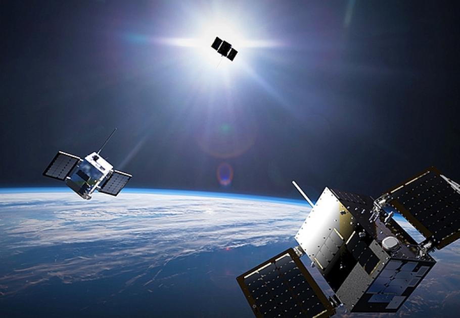
A first-generation HawkEye 360 Pathfinder satellite will be displayed in the new RTX Living in the Space Age exhibition that is anticipated to open in 2026 at the National Air and Space Museum in Washington, D.C.
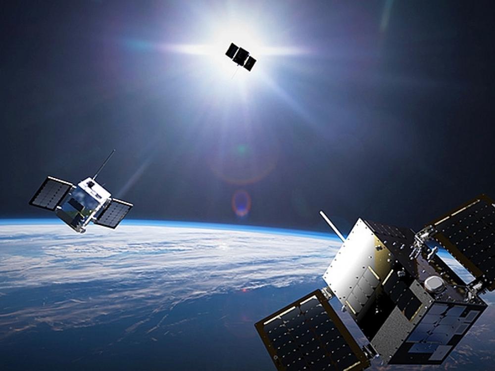
The HawkEye 360 Pathfinder bus measures approximately 18 inches long, 11 inches wide, and 8 inches deep. Several antennas of varying lengths are attached to the bus. Some intercept radio frequency signals, while others downlink the intercepted signals and telemetry to a ground station or receive commands from the ground station. Other components include a programmable Software Defined Radio to detect and intercept the radio frequency signals, solar panels to provide power, a new water-fueled electro-thermal propulsion system, and a GPS receiver. Three satellites are launched together into a near-polar, low-Earth orbit, at an altitude of approximately 360 miles. This orbit allows them to cover every point on Earth frequently. As depicted in the illustration below, they fly in formation about 78 miles from one another. The analytics performed by the company often use data from other sources, delivering a product to customers not previously commercially available. For example, the product enriches satellite imagery analysis, providing guidance on where to image and helping assess what is being viewed.
SpaceX launched three Pathfinders from Vandenberg Air Force Base in California, in December 2018. These were the first HawkEye 360 satellites to reach orbit. After commissioning and testing, they achieved operational status two months later. The three satellites successfully detected and geolocated over 20 million transmitters in the first 18 months of operations, including maritime very high frequency radios and radars, emergency beacons, and vessel Automatic Identification Systems. The company established RFGeo, its first commercially available product, to disseminate the data to customers. Since then, it has created other products to meet the growing customer requirements. The experience gained with these initial satellites led to improved follow-on satellites.
The second set of three satellites, Cluster 2, was successfully placed in orbit by SpaceX from Cape Canaveral, Florida, in January 2021. Among other differences, they were slightly larger and carried an advanced Software Defined Radio capable of detecting a wider range of radio frequency signals and do so simultaneously. Improved onboard processing resulted in greater accuracy in determining the geolocations of transmitters. From the same launch complex, SpaceX launched Cluster 3 in June 2021, Cluster 4 in April 2022, and Cluster 5 in May 2022. The current plans are to launch Cluster 6 later in 2022. Together, the new clusters will double the constellation’s on-orbit capacity, expand the range of detectable radio frequency signals, and enable a global revisit rate of less than an hour.
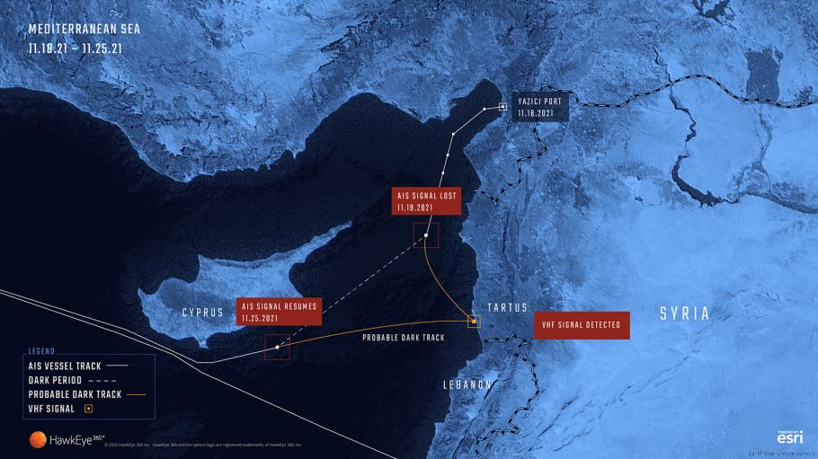
Tens of thousands of vessels are on the world’s vast oceans every day. Maintaining maritime awareness into their operations is critical to the security, safety, economies, and environments of the United States and other nations. But achieving that awareness is a huge challenge. All large vessels carry the Automatic Identification System (AIS) and transmissions have mostly been used to identify vessels, aid navigation, and prevent collisions. To hide possibly illegal activities, however, some vessels turn it off or spoof it, so the transmissions indicate a false location or identity. However, HawkEye 360 satellites can still detect and geolocate transmissions of radars, radios, and even mobile satellite devices from the vessels. This information allows officials to determine likely voyage patterns during AIS dark periods and helps assist in further investigations of the suspicious activity.
On November 18, 2021, a vessel left the port of Yazici in Turkey and headed southwest through the Gulf of Alexandretta. Its AIS transmissions identified it as the Honduran-flagged vessel, CPT. AHMAD II. Three days into the voyage, the crew turned off the AIS and did not turn it back on until November 25.
The gap raised several critical questions. Was this dark period intentional? Did the vessel deviate from its intended path? Did it visit a port in a sanctioned country or rendezvous with another vessel at sea?
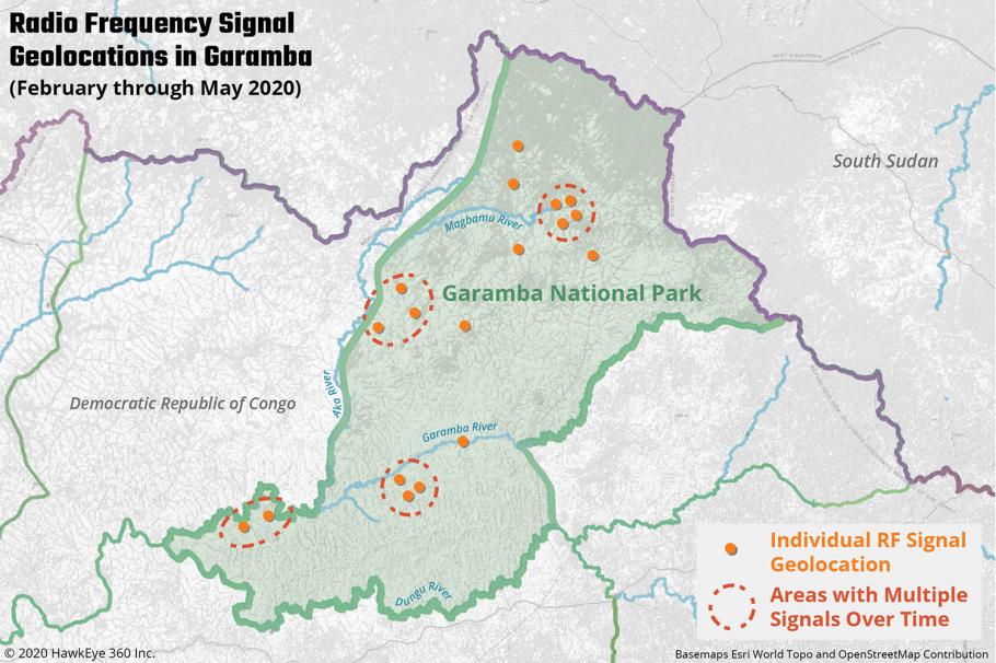
Garamba National Park, in the Democratic Republic of Congo, was established in 1938 and is one of the oldest national parks in Africa. The park is in the northeast corner of the Congo, sharing a border with South Sudan. A UNESCO World Heritage Site, Garamba is home to a diverse range of wildlife, including elephants and the critically endangered Kordofan giraffe. Protecting the wildlife in the park is challenging because of its large size, isolation, and porous borders. Poachers have reduced the elephant population from an estimated 22,000 in the 1970s to fewer than a thousand today, although conservation efforts by the rangers since 2016 has decreased poaching by 90%.
While exploring the use of radio frequency data to protect sensitive environments in March 2020, HawkEye 360 supplied Garamba officials with data on the presence of sophisticated communications technology within the park. Use of this technology is rare in the region, so when the satellites detect and identify such signals it can be a significant indicator of certain human activity.
These are just two examples of the benefits provided by the HawkEye 360 constellation. Undoubtedly, the benefits will increase in the coming years as more satellites join the constellation and analytical techniques are refined.
We rely on the generous support of donors, sponsors, members, and other benefactors to share the history and impact of aviation and spaceflight, educate the public, and inspire future generations. With your help, we can continue to preserve and safeguard the world’s most comprehensive collection of artifacts representing the great achievements of flight and space exploration.
We rely on the generous support of donors, sponsors, members, and other benefactors to share the history and impact of aviation and spaceflight, educate the public, and inspire future generations. With your help, we can continue to preserve and safeguard the world’s most comprehensive collection of artifacts representing the great achievements of flight and space exploration.