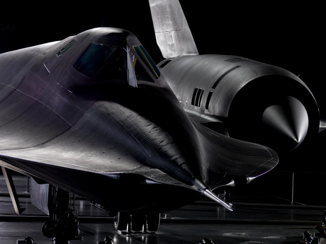
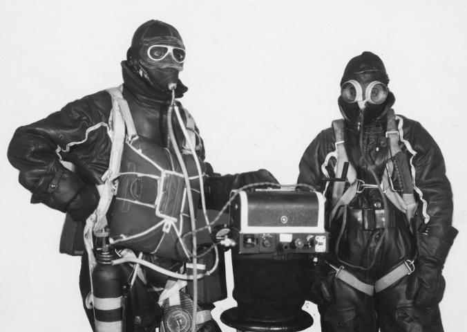
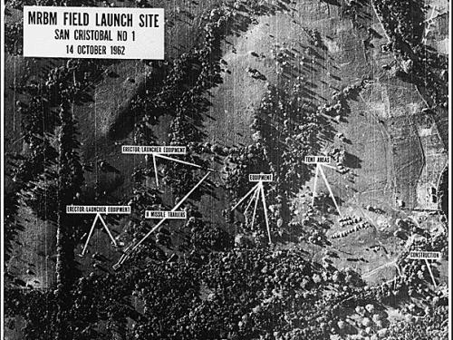
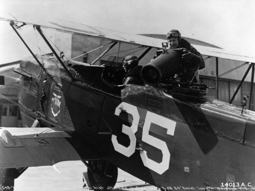
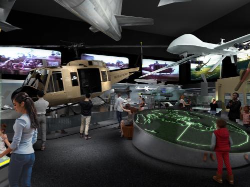
Looking at Earth

The Sky Spies

One of the major uses of aerial photography is the gathering of military intelligence. Usually unsung and unrecognized, photointerpreters and reconnaissance pilots play a vital role, often spelling the difference between success or failure, accuracy or blunder, readiness or surprise.

Early Techniques and Equipment

de Havilland DH-4
The versatile de Havilland DH-4 played many roles in both military and civilian capacities. In addition to its bombing activities in World War I, the DH-4 was an observation and photoreconnaissance aircraft. Between the Wars, the "Liberty Planes," as the DH-4s were called, took on many different jobs, including forest patrols and geologic reconnaissance. For 10 years they served as the Army Air Service's standard airplane for aerial mapping and photography.

The DH-4 was introduced in England in 1917. Because of the War, time for new aircraft development was limited, so an American version of the already existing aircraft was produced in this country. More than 4,000 DH-4s equipped with the American Liberty Engine were manufactured in the U.S. by 1919. The Air and Space Museum's aircraft is the first of these to be built.

Aerial cameras in the DH-4 could be hand-held or mounted either inside or outside the rear cockpit. The aircraft on display contains a Kodak L-4 camera positioned within the cockpit to take photographs through a small window in the floor.

The mannequin in the DH-4 is holding an A-2 camera. The A-2 was developed by Kodak and was used for aerial photography in World War I.

The K-1 Camera was designed by Eastman Kodak for use in World War I. It used 6-inch film and had a built-in magazine.
Courtesy of Defense Visual Information Center.

Early aerial cameras were sometimes mounted rigidly on the outside of an airplane to obtain vertical views. Aircraft vibration, however, proved a serious problem.
Courtesy of Defense Visual Information Center.

In the 1920s, Sherman Fairchild designed the K-3, a revolutionary new aerial camera. Electrically driven, the K-3 had a new shutter and magazine which advanced the technology of aerial photography. Fairchild later started an aerial survey and map-making company (one of many Fairchild companies to come).
From the Sherman Fairchild Collection

Photographer preparing to take high altitude oblique shots with a 24-inch focal length K-3 camera.
Courtesy of Defense Visual Information Center.

This K-3 camera was used between the Wars for experiments in long-range aerial photography.
Courtesy of Defense Visual Information Center.

The K-5 camera was another version of the handheld oblique aerial camera.
Courtesy of Defense Visual Information Center.

Bagley Three-Lens Camera
James Bagley of the US Army Corps of Engineers developed the 3-lens camera around 1917. The three lenses, one vertical and two oblique, provided expanded ground coverage without adding the distortion produced by the wider angle lenses of the day. Operated manually, the camera recorded the three exposures simultaneously on one roll of film.


Photos from the 3-lens camera.
Courtesy of Defense Visual Information Center.


As technology advanced, more and more lenses could be added. Fairchild developed a 5-lens camera around 1926. Actually five separate cameras linked together, the T-3 produced one vertical and four oblique images simultaneously.
Courtesy of Defense Visual Information Center.


Prints from a T-3 5-lens camera.
Courtesy of Defense Visual Information Center.


Portable Photo Lab
To provide quick access to reconnaissance photography, portable labs were sometimes towed into the field. Shown here is an 18-foot long processing laboratory equipped with separate rooms for developing and printing. Inside the lab, which was equipped with its own generator, as many as 200 prints could be processed per hour.
Courtesy of Defense Visual Information Center.


Flying Photo Lab
Rapid photo processing was taken a step further by portable labs carried right on board reconnaissance aircraft.
Courtesy of Defense Visual Information Center.


Flight Lab
This World War II portable darkroom was used for immediate processing of film right on board reconnaissance aircraft. Sometimes swift acquisition of photo intelligence was so important that photo interpreters went along on the reconnaissance mission to radio in instantaneous analysis of the film developed in flight.

George W. Goddard

George Goddard is one of America's foremost pioneers in aerial photography. He started his training at the Officer's School in Aerial Photography, US School of Military Aeronautics at Cornell University in 1917, and later rose to such positions as Director of the Army Photographic School at Chanute Field, Illinois, Chief Photographic Officer in Charge of Aerial Photographic Research at Wright Field, Ohio, and Aerial Reconnaissance Chief of NATO. His work greatly advanced the technology in many fields of aerial photographic science including night reconnaissance photography, in-flight processing, high altitude and long-range lenses, and the use of infrared film for distinguishing camouflage.

George Goddard with a K-7 camera designed for high altitude photography. Goddard foresaw the need for high quality, long focal length lenses to provide detailed long-range reconnaissance.
Courtesy of Defense Visual Information Center.

Goddard (left) with another variation on the K-7.
Courtesy of Defense Visual Information Center.


Goddard pioneered the development of nighttime reconnaissance photography. One night in 1925, he stunned Rochester, N.Y., by igniting an 80-pound flash powder bomb to light up the whole city. The result was the first aerial night photograph. Pictured here is one of his first attempts at recording an aerial view of Rochester at night.
Courtesy of Defense Visual Information Center.


Goddard's technique was used to photograph this night view of an anti-aircraft position camouflaged by smoke pots.
Courtesy of Defense Visual Information Center.


Night photograph of New York City in 1931.
Courtesy of Defense Visual Information Center.

Military Reconnaissance

The zigzag pattern of World War I trench systems could be viewed best from the air.
From the National Archives

The Fairchild K-3B camera was designed for both vertical and oblique photography. It could be operated manually or electrically. Developed in the 1920s, the K-3s were the standard Army and Navy cameras of their day and became the forerunners of many of the major World War II aerial cameras.

Located on the Khwae Yai River in Thailand, the bridge in the background was built by prisoners of war as a vital segment of a Japanese supply route. It was successfully bombed in February 1945 by an American squadron of B-24s.
Royal Air Force Photograph.

Known from the book and movie "A Bridge Too Far", the bridge across the Waal River at Nijmegen, Holland was captured by the Allies, after many losses, on September 20, 1944.
Courtesy of CIA

Peenemunde
Reconnaissance photos show Peenemunde, site of German World War II rocketry research. Arrow indicates V-2 rocket lying on its side. Photos such as these helped Allies to understand the nature of reported new German "secret weapons" research.
Courtesy of CIA

Monte Cassino
Air photos graphically depict the destruction of the abbey of Monte Cassino in southwestern Italy. Monte Cassino was the target of several concentrated Allied air strikes and assaults in the early months of 1944.
From the National Archives

Rotterdam
Aerial scene of World War II bombing around Rotterdam, The Netherlands.
From the Col. Roy M. Stanley Collection.

Corregidor
Aerial view of Corregidor, an island strategically situated in the mouth of Manila Bay in the northern Philippines. After a gallant defense effort by U.S. and Philippine troops, Corregidor was surrendered to Japan in May, 1942, and served as a Japanese garrison for nearly three years.
From the National Archives

Rabaul
Rabaul, located in the South Pacific east of New Guinea, was occupied by the Japanese in January 1942, and became a significant site for air and naval bases. Surrounded by volcanoes and possessing an excellent harbor, the Japanese stronghold was the target of repeated American air attacks which successfully neutralized its effectiveness.
From the National Archives

Fairchild F-1 Camera
The F-1 was a World War II aerial camera designed for taking hand-held oblique photographs in rapid succession. It was used extensively for high altitude photography of military installations.

Auschwitz
An aerial photograph from 1944 shows the Auschwitz concentration camp in Poland.
From the National Archives

Solomon Islands
The Solomons are an island chain in the South Pacific east of New Guinea. During World War II, Guadalcanal and other islands in the group were occupied by the Japanese. Bitter battles in Guadalcanal's jungles resulted in the liberation of the island in 1943.
From the National Archives

D-Day
Far above the raging battles on the Normandy beaches, airplanes recorded a reconnaissance view of the action. Prior to the invasion, a massive photointerpretation effort was launched to identify enemy defenses in great detail.
From the National Archives

K-20 Camera
The K-20 was a lightweight handheld World War II aerial camera. Equipped with a high speed shutter, it was used between 1941 and 1946.


Arctic Seaport
Soviet submarines viewed along the Kola Peninsula in the Barents Sea.
Courtesy of CIA


Bomber Gap
During the Cold War, US officials feared our bomber capabilities lagged behind the Soviets. This 1956 U-2 photo showing details and numbers of Soviet bombers helped confirm that this was not true.
Courtesy of CIA


Panmunjom, Korea
Aerial photo of Panmunjom taken during the Korean Conflict. Panmunjom, located on the dividing line between North and South Korea, was the site of the conclusion of the Korean peace talks.
Courtesy of CIA


San Diego
View of San Diego from a U-2 test run.
Courtesy of CIA


Launch Facility
In 1959, a U-2 aircraft was used to photograph this view of the Soviet space and missile launch facility at Tyuratam.
Courtesy of CIA


Atomic Test Range
Soviet nuclear test site, from a U-2 aircraft.
Courtesy of CIA


Vietnam War
Column of North Vietnamese troops unloading at a railway siding.
Department of Defense Photograph


Grenada
Aerial view of the Caribbean island of Grenada, where US troops landed in 1983.
Department of Defense Photograph

Drones
Automated pilotless aircraft called drones were used for aerial photo reconnaissance during the Vietnam War. This drone is mounted beneath the wing of a military transport plane.
Department of Defense Photograph

Camouflage

Different techniques of camouflage are often used in an attempt to thwart efforts of reconnaissance photographers and confuse photointerpreters. Can you spot the camouflage in these photographs?

This German photograph from World War II shows camouflage in the Kremlin. To the trained eye the "dummy" buildings are clearly evident. The clue is that the real buildings cast long shadows, while the flat false structures have hardly any shadows at all.
Department of Defense Photograph

Oil storage tanks are camouflaged in this photograph. Telltale circular features are visible beneath the false roofs.
Department of Defense Photograph

A World War II aircraft factory is hidden in the photograph on the left. The road that goes nowhere (arrow) is a clue to the deception. Sheets of painted fabric supported by telephone poles have been spread over the plant. Shown in the image on the right is the Lockheed plant in Burbank, California, before the camouflage was applied.
Photographs courtesy of Lockheed Aircraft Company

Inflatable equipment can fool reconnaissance flyers.
Department of Defense Photograph

Japanese boats concealed by local vegetation.
Department of Defense Photograph

Cuban Missile Crisis

Photoreconnaissance played a vital role in the Cuban Missile Crisis of 1962. Aerial photos verified both the presence and removal of Soviet missiles in Cuba.


This U-2 reconnaissance photo showed concrete evidence of missile assembly in Cuba. Shown here are missile transporters and missile-ready tents where fueling and maintenance took place.
Courtesy of CIA


Low altitude view of missile preparation area. The pilot taking this shot flew at an altitude of about 250 feet, and at the speed of sound.
Courtesy of CIA


Photographed from an RF-101 Voodoo, this view of a Soviet SA-2 (surface-to-air) missile pattern provided additional evidence of the Russian arming of Cuba.
Courtesy of CIA


Adlai Stevenson shows aerial photos of Cuban missiles to the United Nations in November 1962.
From the UN Photo Library


President Kennedy meets in the Oval Office with General Curtis LeMay and reconnaissance pilots who flew the Cuban missions. Third from the left is Major Richard Heyser who took the photos on which the Cuban missiles were first identified.
Courtesy of CIA

The Flyers

Reconnaissance pilots and other flight personnel, often unarmed and alone, are the unsung heroes of many a battle and campaign. The invaluable information they gather on an opponent's position, movement, strength, and intentions, provides knowledge for informed decisions, assurance of treaty compliance, and warning of dangers to come.

Because of the classified nature of their work, flyers of many nations go unheralded and unrecognized. Here are but a few Americans who have braved hostile skies in the hopes of collecting that one vital photo that makes all the difference.

Karl Polifka

One of the most famous and daring American reconnaissance pilots was Karl Polifka, who flew missions during both World War II and the Korean conflict. Throughout his career he photographed vital targets in the South Pacific, the Mediterranean, and Korea. When in his mid-thirties and thought too old to fly dangerous missions, he would put himself down in the records as "Lieutenant Jones" and fly anyway. In 1951, he was killed on a reconnaissance sortie to Kaesong, Korea, when his plane was shot down and his parachute caught on its tail.
Department of Defense Photograph

Elliott Roosevelt

Elliott Roosevelt, the son of President Franklin Roosevelt, presenting a reconnaissance briefing to Dwight Eisenhower in North Africa in 1942. In that year Roosevelt was made commander of a photographic unit of the 12th Air Force. While in command, he voluntarily went along on innumerable reconnaissance flights, handling such jobs as photographer, observer, navigator, and radio operator. In 1943, he took command of Allied reconnaissance operations for a large area of the Mediterranean. A Brigadier General by 1945, he received many decorations including the Distinguished Flying Cross.
Courtesy of Defense Visual Information Center

Dicing Shot of the Normandy Beaches
"Dicing" was the term used for the low altitude daredevil sweeps required to obtain close-up oblique views of reconnaissance targets. The term is thought to originate from the phrase "dicing with death".
Courtesy of CIA

Commander William B. Ecker

Cmdr. William B. Ecker took the first low altitude close-up shots of the missiles in Cuba.
Courtesy of Defense Visual Information Center

Major Rudolf Anderson

Maj. Rudolf Anderson, Jr., the sole casualty of the Cuban Missile Crisis, lost his life on October 27, 1962, when his U-2 aircraft was shot down during a photo reconnaissance run. He was posthumously awarded the Purple Heart, the Cheney Award, and the Air Force Cross.
Courtesy of Defense Visual Information Center

Wreckage of Major Anderson's U-2 aircraft which was downed by a surface-to-air missile. .
Courtesy of CIA

Francis Gary Powers

Francis Gary Powers was flying a U-2 reconnaissance mission over the Soviet Union when he was shot down in May 1960. He was later released in February 1962, in exchange for a Soviet agent.

The story of Francis Gary Powers occupies a central place in the history of the Cold War. The U-2 incident came at a time when East-West tensions were easing, or so it seemed. The abortive U-2 flight became one of the issues that canceled the summit conference between President Eisenhower and Premier Khrushchev, which was scheduled for May 16, 1960. The U-2 came to symbolize high-risk U.S. intelligence efforts and the fragility of peaceful co-existence during the Cold War.
Photographs courtesy of CIA

Francis Gary Powers: Imprisoned

Powers spent almost 21 months in prison in the Soviet Union. During that time, he openly kept a diary of his daily activities. In November 1960 he began secretly writing a journal, which opens with a detailed recounting of the downing of his U-2. When released, Powers hid the diary and journal in a rug he had embroidered while in prison and carried them out of the Soviet Union.
These items are a gift of the Powers family, unless otherwise noted

U-2 Pilot Survival Kit

U-2 pilots were equipped with an amazingly complete yet compact kit for survival in the field. Here is just some of the equipment they carried:

Machete
Lip Balm
Desalinization Kit
Shark Repellent
Water Purification Tablets
Sun Goggles
Insect Repellent

Sharpening Stone
Sun Screen
Battery
Survival Manual
Whistle
Compass
(tools)

Fishing Kit
Water Bag
Radio
Sea Dye Marker
Signal Mirror
Signal Mirror
Monocular

U-2 Pressure Suit

This high-altitude partial pressure suit was worn by Francis Gary Powers while test-piloting U-2s for Lockheed after his return from the Soviet Union. First designed in the 1950s, U-2 flight suits were developed to protect against the physiological effects of high-altitude flight. Further improvements to U-2 high-altitude garments were due in part to innovations from early space suit development.
Photo by Eric Long

The "Capstan Principle" The U-2 flight suits were the first to employ the "capstan principle"--using inflatable tubes and cross-stitching to tighten the suit against the pilot's body. This produced mechanical pressure to counteract the expansion of gases and fluids in the body at high altitude.

Lt. Col. James R. Brickel

Lt. Col. James R. Brickel (left), one of the top reconnaissance pilots of the Vietnam War, is shown here on March 10, 1967 after a photo mission over the Thai Nhuyen steel mill (right). During the flight, his aircraft was hit by a 85mm shell which damaged the left engine and aileron.
Photographs courtesy of General James Brickel


Reconnaissance Aircraft

North American 0-47

A 3-seater observation plane used in the late 1930s and early 1940s, the 0-47 was designed to provide a wide field of view for aerial observation and photography.
Model by Ronald Lowery.

Lockheed F-5 Lightning

A reconnaissance version of the P-38, the F-5 received widespread use during World War II in Europe, North Africa, and Japan. Usually flying without back-up fighter escort, the F-5 often carried five cameras in place of weaponry.
Model by Richard Brant.

McDonnell RF-101 Voodoo

A supersonic reconnaissance aircraft, the RF-101 Voodoo flew unarmed and could carry as many as six cameras. Missions flown have included low altitude reconnaissance of the Soviet missile buildup in Cuba, and photo flights over North Vietnam.
Model by Bruce C. Radebaugh.

Lockheed SR-71

First flown in the 1960s, the SR-71 has the unofficial nickname, "Blackbird". It has flown high altitude missions over such areas as Southeast Asia and the Middle East.
Model by Mark E. Young

Lockheed U-2

Developed in the mid-1950s by Clarence "Kelly" Johnson and his team, the U-2 was designed for high altitude photoreconnaissance. Equipped with an 80-foot wingspan to aid in achieving maximum altitude, the U-2 at first could fly over the Soviet Union unharassed by Russian jets and antiaircraft missiles which were unable to match its performance. In 1960, however, the U-2 piloted by Francis Gary Powers was brought down during a reconnaissance mission in Soviet air space. Since that time, U-2s have played a vital role in reconnaissance of the Soviet missile buildup in Cuba in 1962, verification of nuclear testing in China, reconnaissance in Vietnam and the Middle East, and civil disaster assessment and environmental monitoring. The Air and Space Museum's aircraft is a U-2C painted in camouflage colors for a special Air Force project.
Photo by Eric Long

The U-2 B camera has a 36-inch focal length and can resolve features as small as .75 meters (2.5 feet) from an altitude of 19.5 kilometers (65,000 feet).
Photo by Eric Long

Presidents and Reconnaissance

U.S. Presidents have long relied on the accurate and up-to-date intelligence provided by aerial reconnaissance.


President Franklin D. Roosevelt and George Goddard view an aerial photograph.
Courtesy of Defense Visual Information Center


President Dwight D. Eisenhower discusses the role of U-2 aircraft.
Courtesy of Dwight D. Eisenhower Library


President Lyndon B. Johnson views a three-dimensional terrain model constructed from the data gathered by aerial reconnaissance.
Courtesy of Lyndon B. Johnson Library


President Gerald Ford studies a topographic model made from aerial photography.
Courtesy of Gerald R. Ford Library


President Jimmy Carter is briefed on aerial reconnaissance.
Courtesy of CIA


President Ronald Reagan addresses the Nation concerning evidence gathered from reconnaissance photography.
Courtesy of Ronald Reagan Library

Satellite Reconnaissance

The next step upward from aerial reconnaissance is orbital reconnaissance. From orbit, satellites can monitor vast areas in great detail.

Discoverer-13 Reentry Capsule

Discoverer was the public cover name for Project Corona, a secret program to develop the first satellites for spying on the Soviet Union. Initiated by the U.S. Air Force in the late 1950s, Discoverer's scientific missions masked an effort to send reconnaissance cameras into space. Early missions were plagued with failure. Not until the launch and recovery of this capsule in August 1960 did the program achieve its first success.

The Discoverer-13 capsule was the first man-made object recovered from orbit. It was designed to carry back to Earth exposed film taken by a camera in space. As a test flight, Discoverer-13 carried no film. But about two weeks later, Discoverer-14 returned the first film from space. The Discoverer program quietly ended in the early 1960s, but Corona continued in secret until 1972. To learn more about Corona, visit the Space Race exhibition.

In February 1995 President Clinton signed an executive order releasing previously classified satellite reconnaissance photography dating from 1960 to 1972. This recently declassified image from August 1962 shows the Aral Sea in the former Soviet Union. Detailed images such as this one may be useful to scientists studying global environmental change over the past decades.
Image courtesy of the National Archives

This Landsat image of the Aral Sea from August 1987 shows the extent of the environmental disaster that has occurred there. Excessive use of pesticides and unwise irrigation practices have poisoned and shrunk this once large and bountiful sea. Compare this image with the one to the left.
Image from EROS Data Center

Satellite Retrieval


Aircraft catches 1960s era reconnaissance-type satellite during its reentry.
Department of Defense Photograph.


President Dwight D. Eisenhower with a successfully retrieved Discoverer capsule.
Courtesy of Dwight D. Eisenhower Library

Reconnaissance Satellite Launches

Photographs courtesy of CIA